About
project | 200 years | river today | beaver | us
The Project
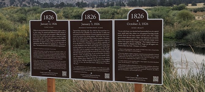
Journal entries on the landscape.
The Hudson Bay’s Company (HBC) came to central Oregon from 1826-1829 with the expressed intent of eliminating beaver. It was part of a 5-year plan to remove beaver from all of the “Oregon Country” to deter American advancement (by reducing an economic incentive) and allow England to claim the land. It failed, as the lure of verdant farm land proved too strong, yet it was a tragic, myopic undertaking that reshaped the Crooked River (and other Oregon watersheds) in ways that are still felt today (e.g., incised streams, loss of water storage, loss of floodplain connection). For more on the HBC and Oregon in the 1820s, see the “Setting the Stage” page.
In addition to leaving deeply-eroding, beaver-less streams, these fur trappers left journal entries that are the first written descriptions of our watershed. They are fascinating for how they capture the tumult of the times and in their descriptions of the people, plants and animals, and conditions found here then.
We bring these journal entries to you, where written … and invite you to see the Crooked with new eyes.
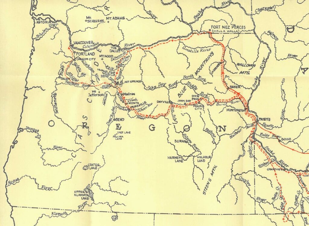
Route of Ogden’s 1825-26 campaign. Dashed red line = outward path; dotted red line = return path (split near Huntington as the brigade divided into two groups, Ogden continuing along the Crooked). The outward path of the 1826-27 campaign was similar, yet from the Crooked River, the brigade continued to the Silvies River and then to the Harney-Malheur basin and westward to the Klamath.
WHAT is this project?
The project consists to 40+ roadside signs that each bear a journal entry and are located where the entry was written, essentially where the brigades camped. For Crook County, there are 36 signs placed at 10 location from the wetlands complex to the headwater, mostly along Route 380 which follows the river. There are also signs at the Warm Springs boat ramp (where the brigade recruited their Northern Paiute guide, traded for supplies, and had a canoe built to cross the Deschutes). Please see map for all locations.
The author of the entries is Peter Skene Ogden, an HBC expedition leader who was trained in law, yet eschewed that field for the adventures of the frontier. He was in his 16th season when entering the 1825-26 campaign. In his writings, he is remarkably adept at concisely imparting varied thoughts (from weather, to Native American encounters, to plants and animals, to the state of his men and their horses, and more) while also going stream-of-conscious and sharing why they are doing certain things or the fears or pressure he feels. This makes his entries highly relatable and engaging.
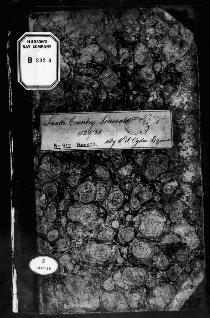
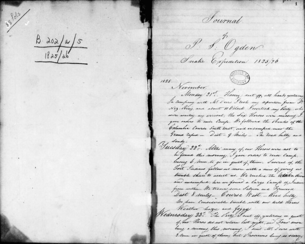
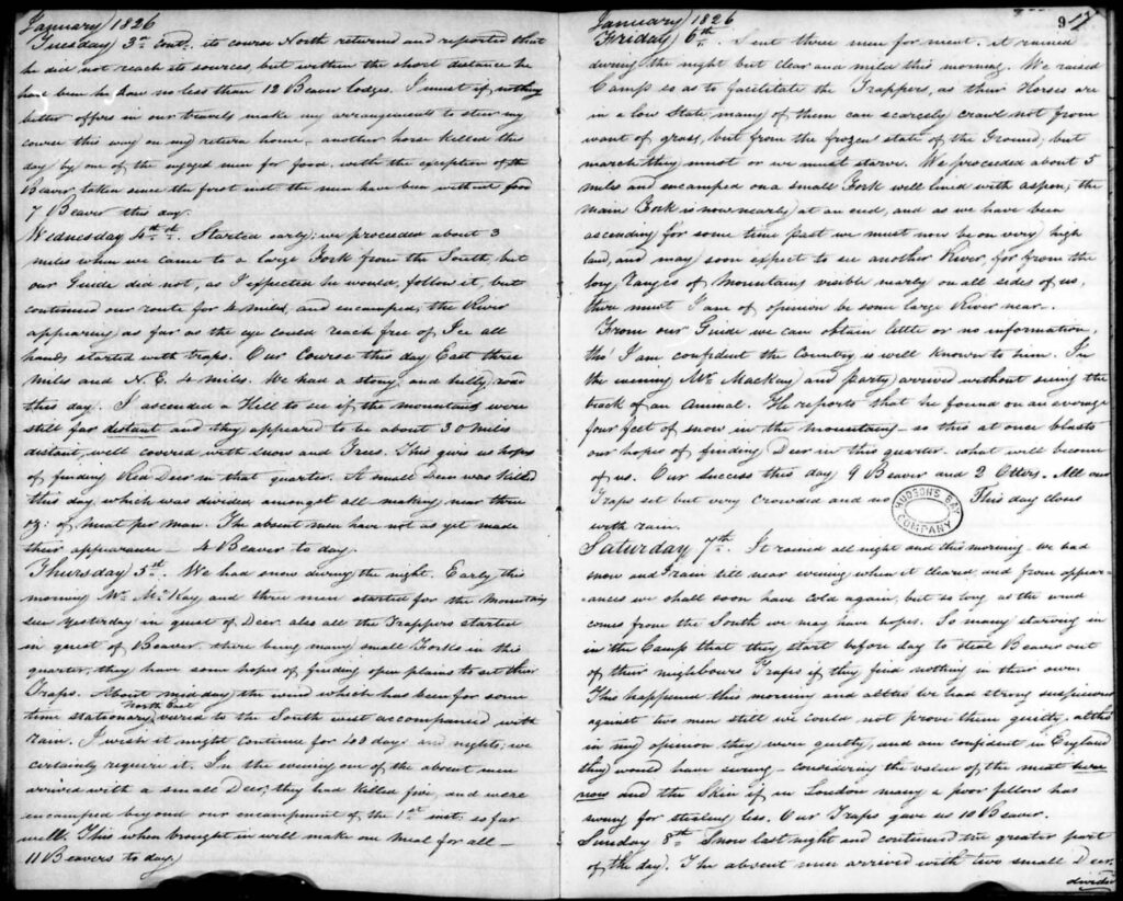
Further, by placing the entries where they were written, you, the viewer, can read them, view the landscape described therein, and come to your own conclusions. This is a remarkable way to experience history. Plus, if you are unable to visit a site in person, our interactive map allows you to do so virtually, though in-person is much better. 😊
The signs are up for a “bicentennial period,” based on the 1826-28 entries, and thus runs until 2028. Be sure to go read them while you can!
WHY do it?
1. Entertainment … and gratitude
Can you imagine what the trappers, and the women or children who accompanied them, endured? Or the local Native Americans? Can you imagine the Crooked River with several thousand beaver and the expansive dam complexes that would have filled the floodplains? Or a large fishing encampment with salmon weirs near Paulina!? … perhaps our own “little Celilo”? What about living outside year round and facing the temperature extremes and food insecurity that the brigade and local Native Americans faced? … or the meeting/mixing of cultures, tools, weapons, food, and values, that occurred? … It’s all in the journals, from the mundane to the stunning.
In addition, understanding living conditions in the 1820s may increase our gratitude for the effort and sacrifice of those who have come before us – who created the stable economy, amenities, and conveniences that we enjoy today … and may even take for granted.
2. Knowing what was … helps prepare for the future
Often people arrive in a landscape and think, “it’s always been this way.” Yet here, as we see from the journals, that is not the case. Knowing what was helps us consider what’s possible. For example, the river, upstream of the dam, is very “flashy” today, meaning that after a rain event, water flows out very quickly through deeply incised or engineered channels. In contrast, 200 years ago, water stayed in the upper watershed and was spread out over the floodplain by an extensive system of beaver dams, thereby supporting abundant forage, recharging the aquifer, and slowly releasing throughout the year. If a person views the landscape today, they would not know this and, hence, likely not consider it as an option for the future.
In addition, as population grows and climate patterns shift, it is increasingly important that we understand and thoughtfully use our water resources. These journals give a base level of understanding that is not apparent when we view the highly diverted and engineered river of today and allow us to consider options that enhance economic opportunity and improve quality of life.
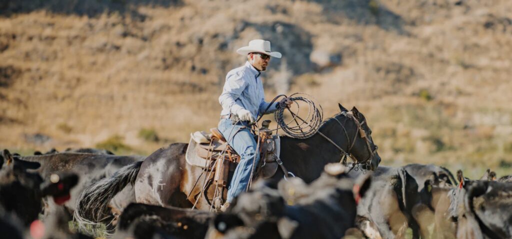
Please note that one example of learning from the past to create a better future is that of Country Natural Beef, a central Oregon based ranching cooperative that uses these journals (for example, vegetation types, flow regimes and distribution, etc.) to inform on “best practices” for sustainable ranching operations. It was these ranchers who first brought the journals to the attention of the historical society. We extend our “thank you!” to them.
3. Tell history in a more relatable way
Consider the adult voices in a Charlie Brown cartoon: “wah-wah.” Sometimes, reading “interpreted” history can feel like this. Reading the first-person journal entries, however, is a different experience. You are the “interpreter,” not a random historian, and you decide what they mean.
See the journal entries here.
4. Community pride
We all feel more pride in our home when we known its remarkable past.
The Crooked River – Then and Now
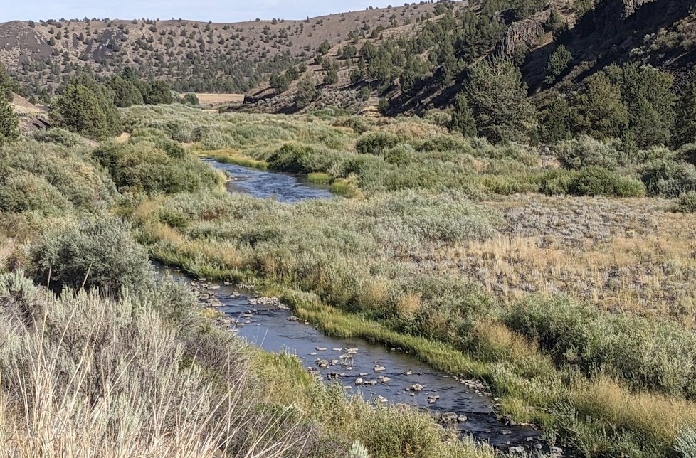
The last 200 years …
Over the last 200 years, five major forces have shaped the Crooked River: beaver removal, legal allocation of water, overgrazing (1880–1930), channelization, and juniper expansion. It is also interesting to note that the first water rights adjudication for the Crooked River happened on the South Fork, in 1866, a mere 40 years after Ogden.
A useful way of considering these forces and how they shaped the river is through the following eras:
Beaver Extermination
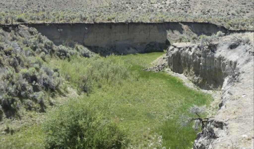
- 1826–1828: beaver extermination. It’s hard to imagine the impact of removing thousands of beaver from an arid landscape. With their removal, dams failed and erosion followed. This was the beginning of the incised streams and disconnected floodplains that are so prevalent today. Many decades later, overgrazing (see below), would remove the remaining bank-stabilizing vegetation, further accelerating erosion, stream incision, and vegetation loss.
Note that while re-establishment of bank stabilizing vegetation is being attempted now (willow and aspen plantings), it is difficult as the incised streams are often too low to sufficiently wet the roots of new seedlings. First, these streams must to be “lifted” and that is done using a technique called (low-tech) process-based-restoration. It may include the use of beaver dam analogs (BDAs) and the like and is described in more detail below in the “Beaver” section.
Water Allocation
- 1860s–1909: settlement and appropriation. Federal land policy encouraged settlement through homesteading and related land laws. In the arid West, owning land was of little use without water, so settlers diverted streams into ditches and put the water to what the law called a beneficial use, particularly irrigation and stock watering. The basic rule that evolved was first in time, first in right: the person who first diverted water and beneficially used it acquired the superior claim.
- 1909–1950: Oregon formalizes the water allocation system. The Oregon Water Code of 1909 declared surface-water to be publicly owned and established a registry for existing rights and a permit system for new water appropriations (ground water was added in 1955, see below). It did not erase older rights. Instead, uses established before February 24, 1909, were treated as vested rights and could subsequently be adjudicated. 1914 is an especially important year for the Crooked River. Oregon conducted a formal adjudication. and produced five volumes titled In Re Crooked River, plus a sixth volume of evidence and testimony, maps, claims, proofs, notices and decrees. A newspaper report in September 1914 said the State Water Board had issued about 200 water-right certificates to Crooked River appropriators following the adjudication.
- 1910s–1960s: water policy moves from individual settlement to large-scale reclamation. Irrigation increasingly became infrastructure. The Ochoco Irrigation District was organized in 1916–17 and constructed Ochoco Dam. After decades of water-supply problems, Congress authorized the federal Crooked River Project in the 1950s; Bowman Dam was completed in 1961. The project’s Crooked River and Ochoco Creek facilities ultimately supplied approximately 20,000 acres.
- 1955 onward: recognizing that the river itself needs water. Oregon’s 1955 Water Resources Act began recognizing minimum perennial stream flows, but the major conceptual change came with the 1987 Instream Water Rights Act. For the first time, leaving water flowing in a river for fish, wildlife, water quality and recreation could itself constitute a water right. Further, in 2014, Congress substantially revises the management of Prineville Reservoir so stored water can explicitly serve irrigation, Prineville groundwater mitigation, and fish and wildlife purposes.
- 2005: water rights online. In 2005, the Oregon Department of Water Resources (ODWR) made their Water Rights Information System (WRIS) available online, followed shortly by GIS-based Mapping Tools. See Accessing water rights below for more information on WRIS and the Mapping Tools.
Overgrazing
- 1880-1930: overgrazing. The open range era was one of intense ecological damage and conflict. Enormous numbers of cattle, sheep and horses grazed central Oregon with few restrictions in a grass-eating “free-for-all.” Native bunchgrasses and streamside vegetation were decimated, and with fewer roots to hold soils (and beaver already gone), high flows caused further erosion, stream incision, and floodplain disconnection. In addition, the overgrazing created a “blank canvas” for the spread of annual invasive grasses (of low nutritional value and highly flammable) and western juniper, formerly held in check by naturally occurring low-intensity wildfire.
- 1900–1906: range wars peak. Vigilante cattlemen groups (like the Crook County Sheep-Shooting Association) slaughtered over 10,000 sheep to protect “their” grass, prompting early federal intervention.
- U.S. Forest Service. Fed up with the ecological ruin and the violence of the range wars, the federal government tasked the newly created Forest Service (est. 1905) with regulating high-elevation timberlands. The USFS began carving up specific grazing allotments on forest lands to keep cattle and sheep legally separated.
- Bureau of Land Management. While forests were now managed, lower-elevation arid rangelands (like much of central Oregon) remained a chaotic free-for-all until the 1930s dust storms. To rescue the landscape from permanent desertification, Congress passed the Taylor Grazing Act of 1934, creating the U.S. Grazing Service. In 1946, this Grazing Service merged with the General Land Office to officially form the BLM.
Today, terrestrial restoration attempts are underway but in arid and semi-arid landscapes, re-establishment of native bunchgrasses is very difficult due to lack of rainfall (which leaves annual invasive grasses with no competition).
Channelization
- 1950s-1960s: channelization. From the late 1950s and through the 1960s, most of the upper watershed was channelized to more quickly pass water to the newly created Prineville reservoir. McKay and Ochoco Creeks were also channelized. It was an era when use of public funds was too heavily influenced by dam-building lobbyists and narrowly-focus Army Corps of Engineers staff. Now, it is widely agreed that this channelization should never have happened (or to a far lesser extent) and caused significant economic, ecological, and societal damage.
In addition, it is unfortunate in that it (1) unfairly “takes” water from upstream residents and passes it to downstream users and (2) removes a human connection to the river by eliminating swimming holes, fishing spots, picnic areas, and the like.
With respect to ecological consequences, straightening the naturally-meandering river was profoundly detrimental as it destroyed crucial wetlands, stripped out shade-giving willows, raised water temperatures, and completely blocked historic spawning grounds for native fish. For example, as recently as the 1950s, anadromous steelhead were still found in the upper watershed. With respect to economic consequences, it (1) locked the river into a single economic use – passing water quickly for the benefit of downstream users – and (2) eliminated economies around fishing, hunting, rafting, swimming, recreation, short-term vacation rentals, and related service and support industries. This also lessens quality-of-life and makes it harder for upstream employers to recruit and retain employees (which may also decrease school enrollment levels, etc.) – factors not often included in economic calculations.
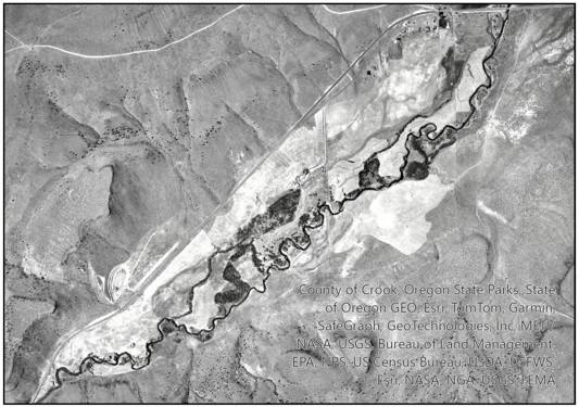
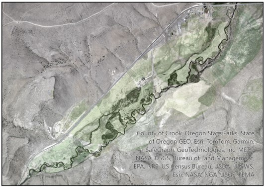
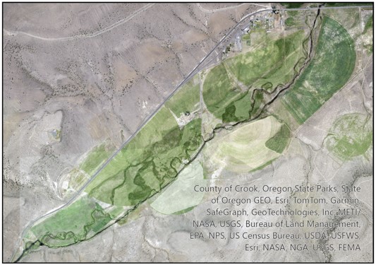
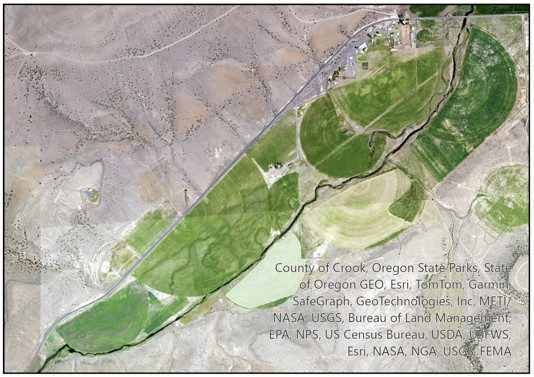
The below photo-series shows the channelization of a section of Beaver Creek, at Paulina. The first photo is from 1960 (Paulina is upper right, rodeo grounds lower left). Beaver Creek is converted from a meandering, multi-thread system to a single channel. Similar work was carried out throughout the upper mainstem, Ochoco Creek and McKay Creek.
Channelization of Beaver Creek, at Paulina (1960-2020)
Juniper Expansion
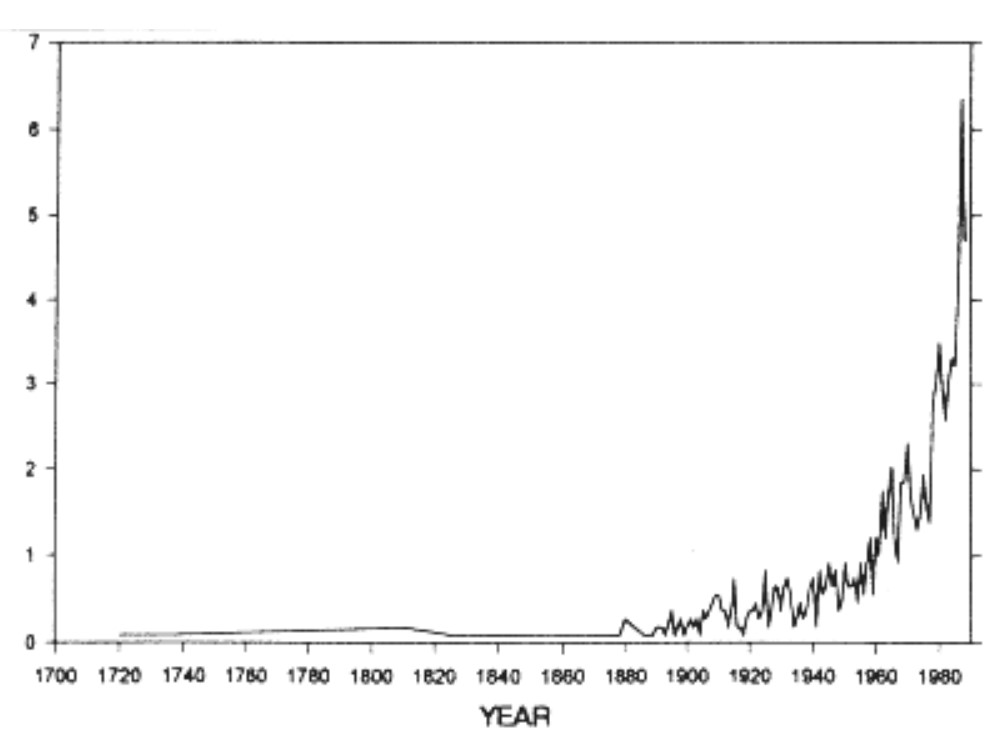
- 1960s–present: accelerated juniper expansion. Historically, juniper was held in check by low-intensity wildfire and confined to steep, rocky bluffs – low-intensity because the primary fuel was native bunchgrasses which are naturally dispersed. Overgrazing caused a change in the grass layer to annual invasive grasses which are highly flammable and form a continuous fuel bed, heightening fire concerns and a predisposition towards fire suppression. An unintended consequence of this fire suppression has been the exponential expansion of western juniper. From an establishment period of 1880 to 1950, juniper expansion has accelerated (with increased fire suppression) since the 1960s. The Crook County NRCS states that 350,000 acres of privately owned rangeland in the county have been invaded by juniper.
Juniper is problematic in that it branches intercept precipitation (which is then lost to evaporation) and its roots are highly effective at uptake of soil moisture, thus depriving (and eliminating) other vegetation. The NRCS identifies juniper as a major cause of declining rangeland health and water quantity and both NRCS and the the Crook County SWCD (Soil and Water Conservation District) have programs to help landowners remove it. For more info, see the Juniper section below.
What’s it all mean?
Understanding prior appropriation
The federal government encouraged Western settlement by granting or making inexpensive land available under programs such as the Homestead Act. Water rights were generally not simply handed out automatically with the land. Instead, settlers acquired water rights by appropriating water and putting it to beneficial use under territorial/state law and Western custom.
The underlying philosophy was: unused land + unused water = wasted economic opportunity. A settler who cleared land, dug a ditch, diverted water and produced hay or livestock was regarded as improving the land. Water flowing unused down a stream was often perceived economically as a resource that had not yet been developed.
Oregon’s own current Integrated Water Resources Strategy acknowledges this history. It explicitly connects prior appropriation with nineteenth-century homesteading policies and says the 1909 code effectively grandfathered existing rights that had arisen during that settlement period.
Senior vs junior rights … doing the math
A water right usually identifies things such as a priority date, source, point of diversion, place of use, authorized purpose, maximum diversion rate and sometimes an annual volume. During shortage, seniority matters enormously.
Example: if Ranch A has an 1870 irrigation right and Ranch B has a 1920 right, Ranch A can generally demand its authorized water before Ranch B receives water. Oregon describes it quite plainly: an older right can receive its water during shortage regardless of the needs of junior users. This works reasonably well as a property allocation system, yet it can work badly as an ecosystem management system.
Imagine that by 1900 virtually every summer gallon was legally spoken for. Then in 1987 Oregon creates an instream water right for fish. That new right normally has a 1987 priority date. An 1880 irrigator is therefore vastly senior to the fish … and also to human recreational use (think “swimmin’ hole”). So simply saying: “The river should have 50 cfs” doesn’t necessarily create 50 cfs. The water may already belong legally to a senior right holder.
Note that this is why modern river-restoration and community enhancement programs frequently rely on buying, leasing, transferring or conserving old irrigation rights and converting some of that senior entitlement to instream use. Oregon has become fairly active in voluntary instream transfers and leases for exactly this reason. In central Oregon, the Deschutes River Conservancy is quite active in this area.
Minimum perennial streamflows
A legal “minimum instream flow” is not necessarily a guarantee that the river will contain that amount of water. In fact, Oregon’s own Water Resources Department says this explicitly: instream water rights “are not guarantees that a certain quantity of water will be present in the stream.” The reason is priority.
Imagine a simplified Upper Crooked River with the following rights, and suppose the state says the river should have 20 cfs:
| Priority | Right | Amount |
|---|---|---|
| 1872 | Ranch A irrigation | 15 cfs |
| 1885 | Ranch B irrigation | 10 cfs |
| 1901 | Ranch C irrigation | 8 cfs |
| 1960 | Ranch D irrigation | 5 cfs |
| 1988 | Instream right | 20 cfs |
Now suppose that in August the natural river produces only 25 cfs. The 1988 instream right does not get its 20 cfs first. The watermaster works down the priority list. Ranch A can take its lawful amount. Then Ranch B. By that point the entire 25 cfs could be gone.
The 1901 and 1960 ranches might get nothing. And the river’s 1988 right might get nothing. That’s because an instream right is administered like any other water right. It can shut off water rights junior to it, but it cannot take water away from rights senior to it. And many agricultural rights in the Crooked River basin date to the late 1800s, whereas Oregon didn’t establish its modern instream-water-right system until 1987.
Authorized diversion vs actual diversion
There is authorized diversion and actual diversion and except for irrigation districts (which typically monitor diversions), the latter is usually not well measured. Suppose on August 1 that the upper Crooked River reaches a particular point with 40 cfs natural flow. Then there are twenty diversions between there and Prineville Reservoir. If every diversion were continuously metered and publicly reported, we could construct something like:
40 cfs entering reach
− 4.2 cfs diversion
− 2.7 cfs diversion
− 6.1 cfs diversion
− 3.8 cfs diversion
− evaporation/seepage/gains/losses
…
= 0 cfs reaching Prineville reservoir
Then we could ask the important questions: Are those withdrawals within their water rights? Are they actually using their full legal entitlement? Are some diversions inefficient? How much is lost through conveyance? Would leasing 5 cfs of a particular senior right instream keep several miles of river wet? And, how much water would remain, if the watershed itself retained more spring runoff through beaver dam complexes or other infrastructure? Without good measurement, those questions become much harder to answer.
Accessing Water Rights
In 2005, the Oregon Department of Water Resources (ODWR) made their Water Rights Information System (WRIS) available online, followed shortly by GIS-based Mapping Tools. The two portals offer related, but different features.
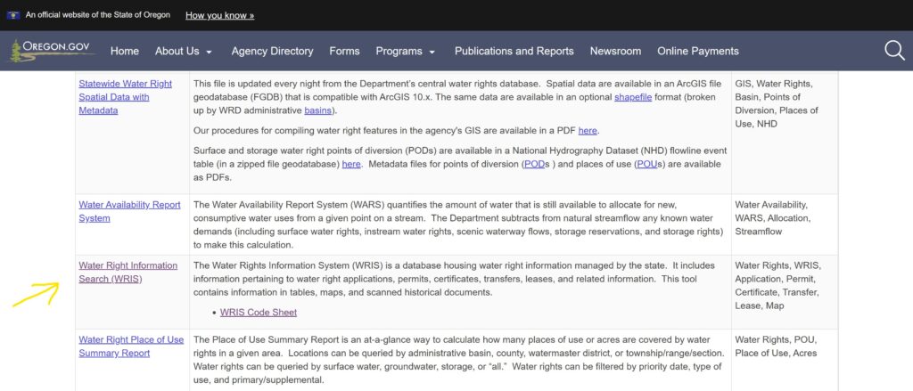
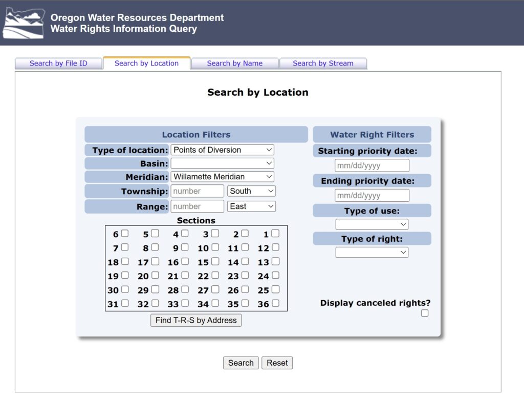
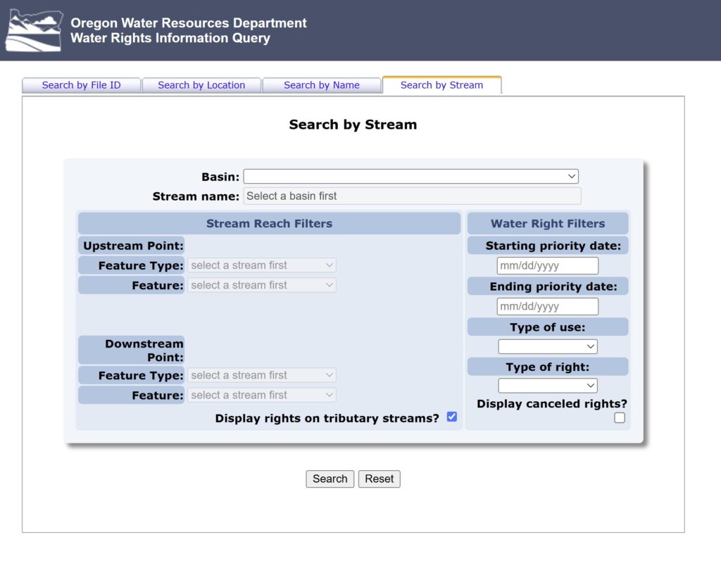
WRIS is a text-based database search to be used if you have specific data, such as a property owner’s name, a water right certificate number, or legal descriptions (township and range). It provides detailed text records, scanned deeds, and water logs. To see, click here, and scroll down to WRIS.
The Mapping Tool is a visual GIS application, through ArcGIS Online, to be used if you don’t have paperwork but want to zoom in on a map of Oregon, click on a specific creek or tax lot, and see the water lines, points of diversion, or restrictions. To see, click Mapping Tools. Note that the Mapping Tool can be used to get the Township and Range for a WRIS search.
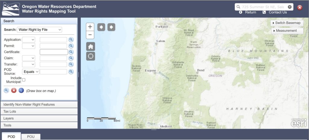
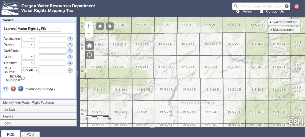
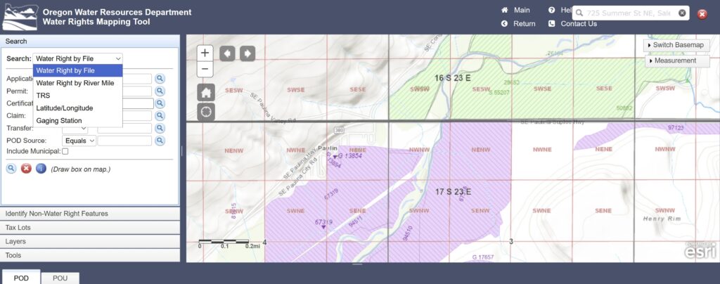
Comparing Idaho and Oregon
Below is a screenshot of the Water Right Locator of the the Idaho Department of Water Resources. To access, click Water Right Locator and zoom into a location of interest. Each water right is identified with an icon and clicking that icon returns all the pertinent information – registration number, active status, rate, source, etc. Pretty slick, eh?
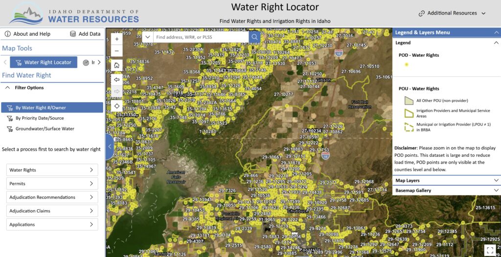
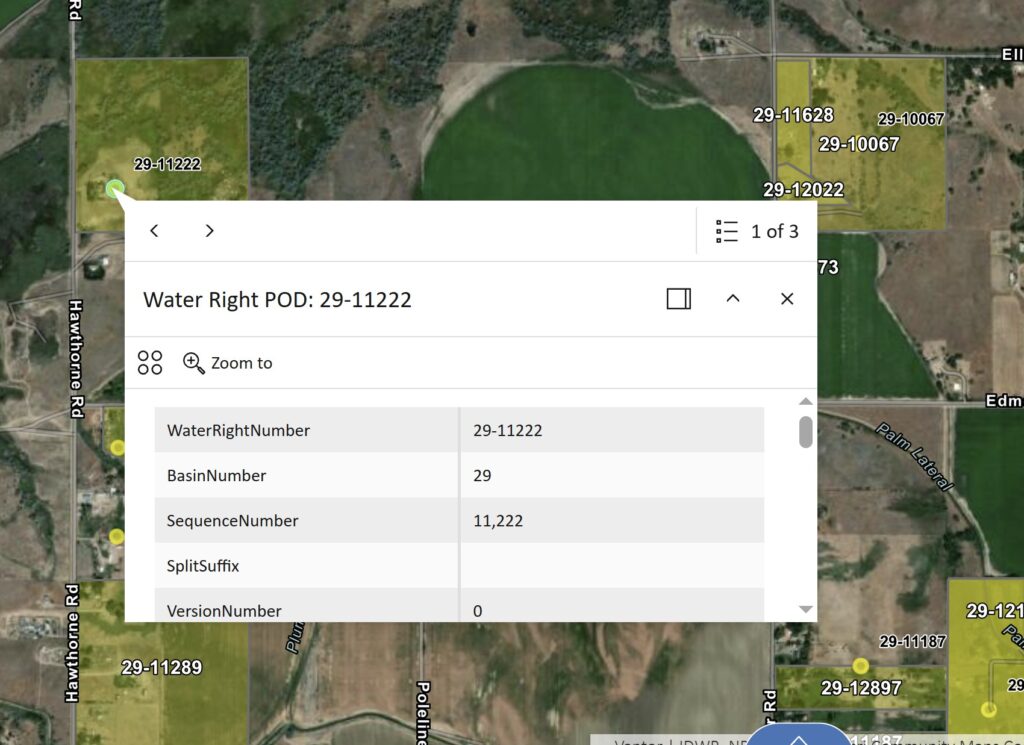
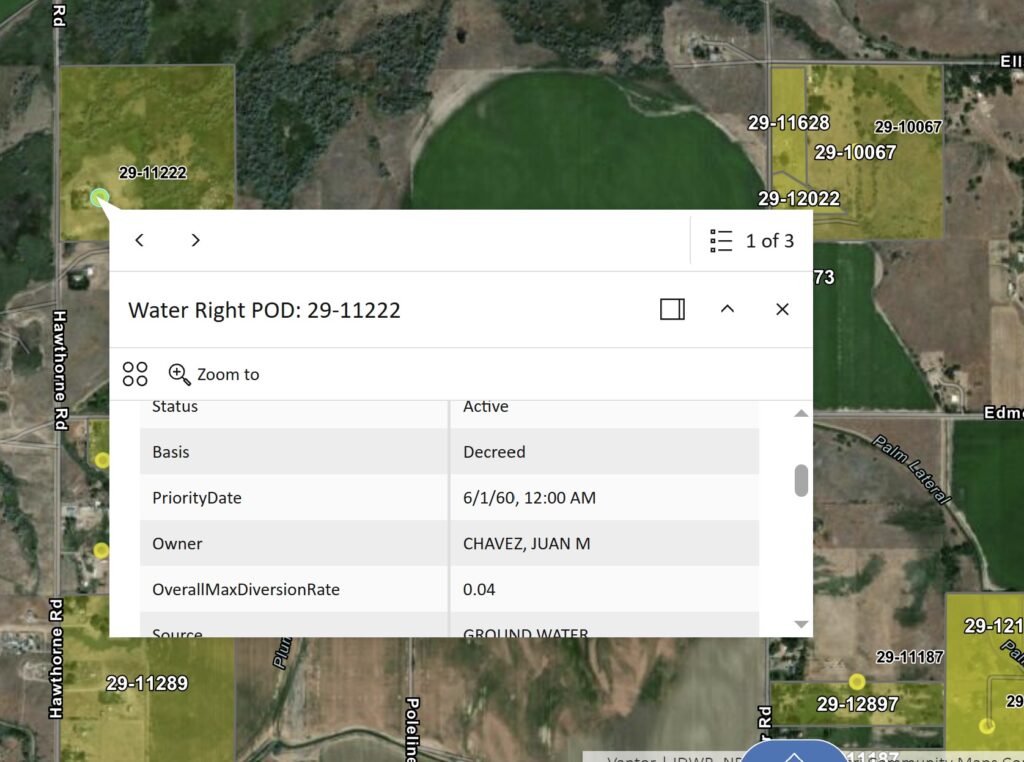
Why is Idaho different? Idaho and Oregon use the same water law – prior appropriation. The difference lies in adjudication and administration. Idaho undertook the Snake River Basin Adjudication (SRBA) beginning in 1987. It was an enormous state-court proceeding whose purpose was essentially:
Find the water rights.
Determine whether they are valid.
Determine their priority.
Determine quantity, source, point of diversion and place of use.
Put them into a unified legal record.
The final unified decree was signed on August 25, 2014. That process took 27 years! But the result was an extraordinary institutional infrastructure. IDWR can now connect:
water-right number → owner/right → priority → point of diversion → place of use → scanned records → decree information → GIS geometry
Its public research database specifically provides GIS maps, scanned documents, details reports, ownership/pedigree history and decree provisions. Idaho now has general stream adjudications covering nearly the entire state.
Oregon followed a different path
Oregon did some adjudications very early — including, importantly, the Crooked River in 1914. But Oregon never subsequently undertook a modern statewide adjudication comparable to Idaho’s Snake River effort. In fact, OWRD itself says: “Adjudication must be completed to understand the full extent of legal surface water use in a given area.” Today, Oregon’s major ongoing unfinished adjudication is the Klamath Basin. That gives you an important distinction.
The Crooked River may have an old adjudicated foundation, but its records were created (as seen above) in the world of:
paper maps
township/range/section descriptions
ditch names
hand surveys
individual certificates
county records
Oregon largely digitized and interpreted this inherited patchwork, yet OWRD warns users that its online WRIS information is derived from interpretations of paper records and that users should consult the underlying water-right documents for authoritative details.
Why did Idaho undertake a statewide adjudication? What do you think? One likely explanation is that the entire state of Idaho is arid (0-10″ annual precipitation) or semi-arid (10-20″ annual precipitation). That is not the case with Oregon, so perhaps there was less urgency here to adjudicate every water way or right. Oregon is substantially adjudicated, yet for any given stream, if there is an issue, all parties are free to present evidence that might establish their right. After which, for that given water right or stream, there is an adjudication. Thus, Oregon’s system is rather notice driven (notice of an issue), whereas Idaho pre-emptively adjudicated and made water rights public so that society and local economies can move forward with predictability.
The Crooked River Today — A Story of Two Rivers
The Crooked River today is, in many respects, a story of two rivers: upstream and downstream of Bowman Dam. Below the dam, releases from Prineville Reservoir regulate flow, making the river relatively stable and predictable. That dependable water supports irrigation and other economic uses, while also sustaining a popular recreational river for fishing, rafting, swimming, camping, and hiking.
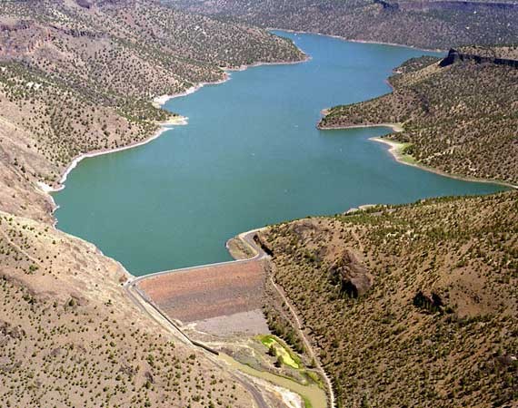
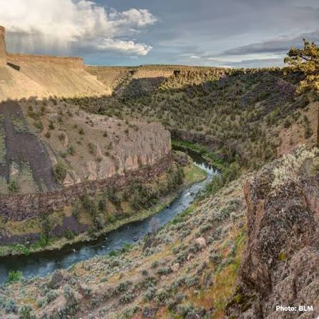
Above Bowman Dam, the story is very different. The upper Crooked River and its tributaries remain largely unregulated. Snowmelt and spring rains can send large volumes of water rapidly downstream, while by mid summer some reaches have no water at all. In 2026, for example, the river ran dry (at Long Hollow, the east gate to the Prineville Reservoir State Park) from mid-July to November. While 2026 was a drier year, it should be noted that as recently as several decades ago, the river flowed continuously all year.
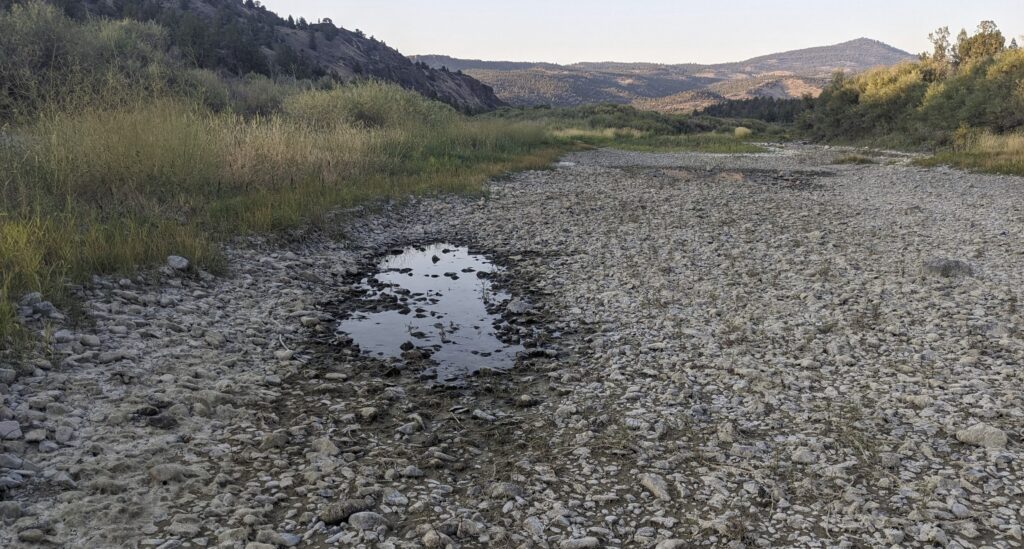
Irrigation withdrawals are an important part of that story, but so too are changes to the watershed itself. Over the past two centuries, riparian vegetation has been lost, wetlands have been destroyed, and many stream channels have become straighter, deeper, and disconnected from their floodplains. There has also been significant intentional channelization. Water that once spread across broad valley bottoms and remained in the watershed longer now moves downstream much more quickly.
There is another important difference between these two rivers. The upper watershed is where Peter Skene Ogden and the Hudson’s Bay Company found—and trapped—extraordinary numbers of beaver in the 1820s. Those beaver were not simply inhabitants of the river. They were helping to shape it. Their dams slowed water, spread it across floodplains, raised local water tables, created wetlands, and stored water in the landscape. The thousands of beaver encountered by the early fur trappers therefore tell us something about what the upper Crooked River once looked like—and how differently it may once have functioned.
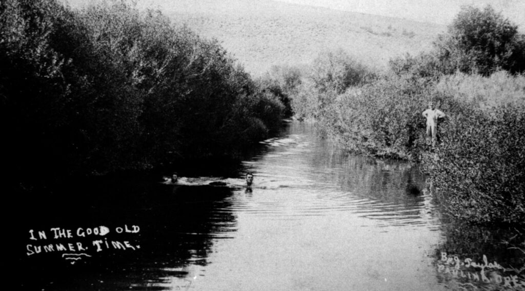
In a sense, the two halves of the Crooked River now illustrate two very different ways of storing and releasing water. In the lower watershed, a large earthen structure captures water and releases it gradually through the year. In the upper watershed, there is no comparable reservoir. Historically, however, beaver dams, wetlands, floodplains, and dense streamside vegetation performed some of the same functions on a much more dispersed scale: slowing runoff, storing water throughout the valley floor, and releasing it gradually back to the river.
Restoring beaver and beaver habitat will not turn the upper Crooked River into Prineville Reservoir, but restoring the processes that beaver once helped maintain could make the upper watershed better able to hold onto the water it receives. The question, then, is not simply how much water enters the Crooked River each year. It is also, how quickly that water leaves—and how much can be retained in the landscape along the way.
The Irony and the Arc
Stated simply, the irony of the “bicentennial” is that what the upper watershed needs most now – smart water storage – we had 200 years ago in the form of willow-rich streams and countless beaver dams.
The arc is that today we better understand what we’ve lost (and how we lost it) and we’re making efforts to restore it. It is a daunting task and will require buy-in and great effort over a long time – but what other options do we have? Doing nothing is not an option, and simply building more concrete dams and channelizing streams is a dystopian future that none of us want to experience. Thus, the hope is to preserve the good that we’ve achieved and work toward restoring what we lost … in a manner that provides desired water storage, restores ecological function, and creates more diversified economic opportunities.
How do we do this you ask? Good question. There are generally two approaches to riparian (streamside) restoration: heavy equipment and process based restoration, and they both have a role though the latter is gaining great steam.
- The heavy equipment approach, sometimes called the “Tonka toys approach” is used when it is necessary to move earth and/or significantly change the geomorphology (shape) of stream beds and waterways. One example is undoing channelization and moving earth to reconnect or reform abandoned channels. Another example is returning large woody debris (such as large tree stumps or whole trees) to a waterway to provide fish habitat, bank stabilization, and /or pool-creating scour.
Ochoco Creek Restoration Project. Recently, the Deschutes Land Trust was awarded a $4M grant for work that uses this approach to un-channelize sections of lower McKay and Ochoco creeks. Here’s a link to that project.
- Process-based restoration is a low-cost approach that uses fence posts, branches and other natural materials to mimic beaver activity, allowing natural processes to gradually restore the stream and eventually become self-sustaining. Given its low-cost, effectiveness, and fun and engaging manner of implementation, it’s becoming very popular with demand outpacing supply. If you’re lucky, it will come to a watershed near you very soon! See Process Based Restoration section below.
Beaver
Family Life
What are beaver? Beaver are highly social animals whose lives revolve around the family. A typical colony is really a family: an adult breeding pair, their kits born that year, and usually young from the previous year. A well-established colony commonly contains five or six beaver, although families can be larger. The adults generally form long-term pair bonds, and together the family maintains its lodge or bank den, food supply, dams and territory.
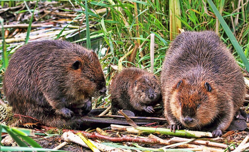
Kits are born in spring or early summer, already covered with fur and able to swim soon after birth. They remain with their parents for about two years, learning and helping with the work of the colony—gathering food and assisting with the maintenance of dams and lodges. At about two years of age, the young beaver typically leave their family territory and disperse in search of a mate and a place to establish a colony of their own.
A beaver family may occupy the same stretch of stream for many years, continually repairing dams, cutting vegetation, digging channels and responding to changes in water level. What begins simply as a family making a safe place to live can, over time, transform an entire valley bottom. That ability to reshape its surroundings is what makes the beaver much more than just another animal living along the river—and leads to the remarkable ecological services described next.
What Beaver Do
Beaver are often called ecosystem engineers because they can transform streams and valley bottoms. Among the services they provide, beaver:
- Store water and sustain summer flows. Dams slow runoff and store water in ponds, streambanks, floodplains and shallow groundwater. Rather than quickly leaving the watershed, some of this water is released gradually back to the stream, helping maintain wetlands and streamflow later into the dry season.
- Reconnect streams with their floodplains. Beaver dams slow water and trap sediment. As sediment accumulates, the streambed can gradually rise—a process called aggradation. Water can then spread onto former floodplains, raising the water table and reversing some of the effects of stream incision.
- Reduce the force of floods. Beaver ponds, wetlands and connected floodplains temporarily store high flows and release them more slowly. By spreading water across a wider area, they can also reduce its velocity and erosive force.
- Create productive riparian habitat. Higher water tables support willows, sedges, grasses and other vegetation, increasing forage and creating habitat for birds, mammals, amphibians and other wildlife. Ponds, side channels, pools and flooded vegetation also provide important feeding, rearing and refuge habitat for juvenile fish.
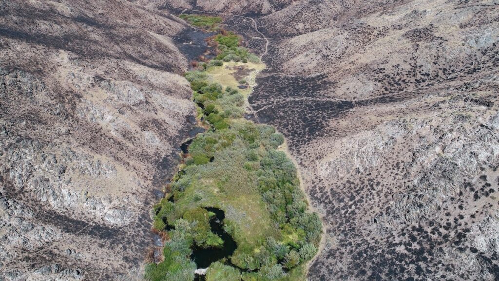
- Create natural firebreaks and refuges. Beaver-maintained wetlands can remain wet and green when the surrounding landscape becomes dry. During wildfire, these wet valley bottoms can burn less severely and provide refuges for wildlife; afterward, they can also serve as islands from which vegetation and wildlife recolonize burned areas.
Most of these benefits arise from one remarkably simple change: beaver slow water down and spread it out. In an arid landscape such as the upper Crooked River, they don’t create more water—they help keep the water that does arrive in the landscape longer.
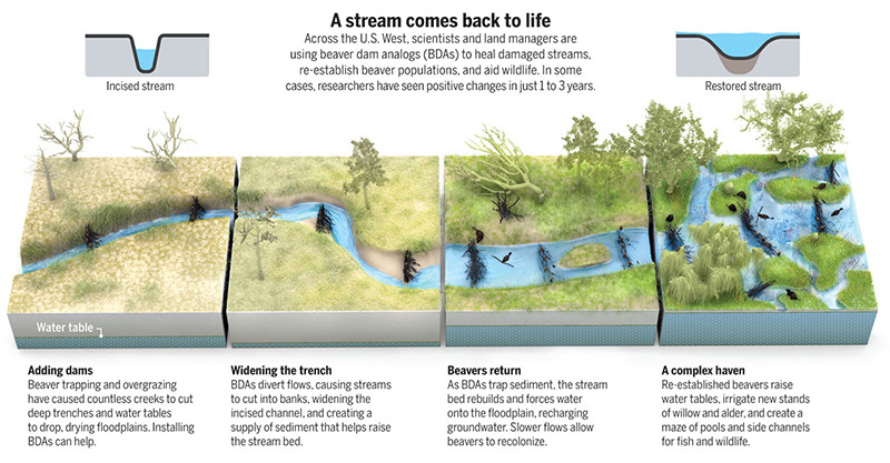
The below diagram shows how beaver can transform a desiccated landscape and incised stream into a forage-rich and ecologically diverse riparian zone, assuming there is sufficient food (and shelter) for the beaver to establish in the first place.
And the following image shows how beaver streams can serve as a fire break and refuge.
Here is a fun link for those who want to learn more:
https://www.fisheries.noaa.gov/feature-story/oregon-beavers-engineer-better-fish-habitat-more-fish
(Low Tech) Process Based Restoration
Well, what if you don’t have beaver or the site is not yet ready for them (not enough willow or aspen to eat) or perhaps the site is not appropriate for beaver (flood concerns), but you want their services? … Enter Process Based Restoration or PBR for short.
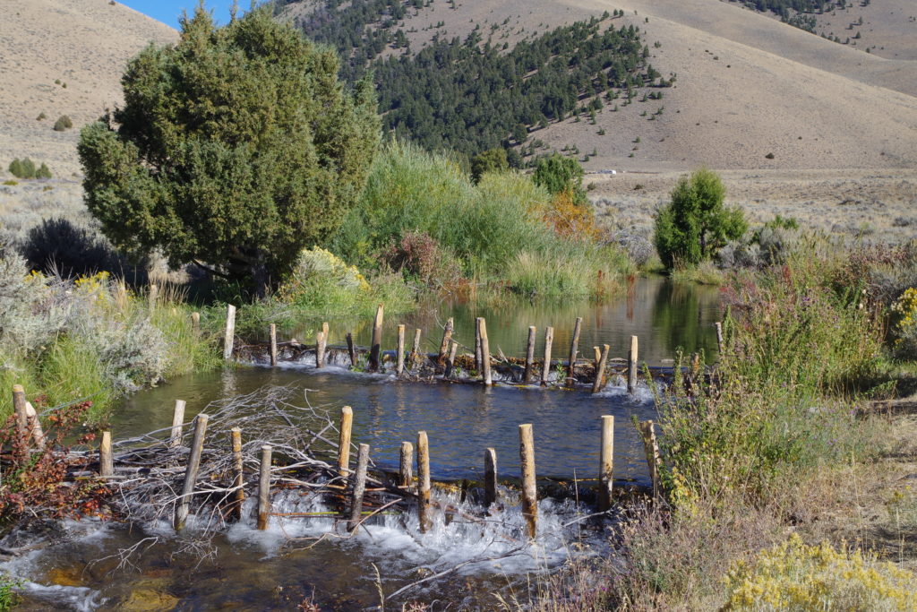
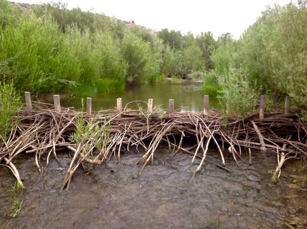
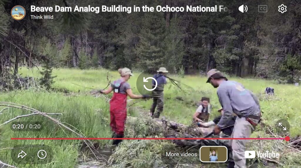
The idea is surprisingly simple: instead of trying to engineer a finished stream, give natural processes a helping hand and let the stream begin repairing itself. Process Based Restoration uses simple, inexpensive structures made largely from natural materials to slow water, trap sediment, raise streambeds, spread water onto floodplains and encourage the return of riparian vegetation. Two of the most common tools are Beaver Dam Analogues (BDAs), which mimic some of the functions of beaver dams, and Post-Assisted Log Structures (PALS), which mimic the effects of naturally accumulating wood. BDAs and PALS are made by driving wooden posts into the ground and weaving branches between them to approximate a dam. Given this simplicity and low-cost, the label “low-tech” often applied to PBR, and you will see “LTPBR” in some references.
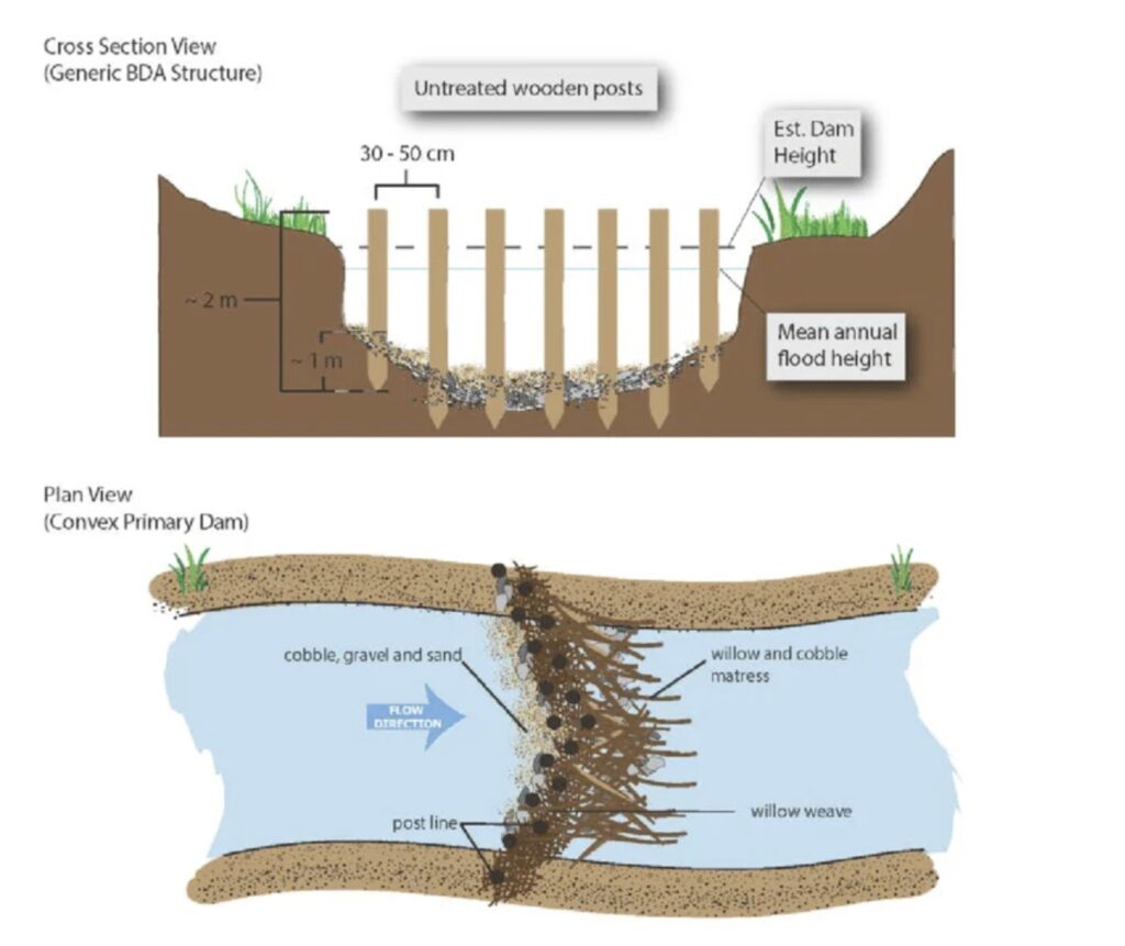
The structures themselves, however, aren’t really the point—and they aren’t necessarily intended to last forever. The goal is to restart the processes that healthy streams once performed on their own. Water slows, sediment accumulates, channels begin to aggrade, floodplains reconnect, vegetation expands and habitat becomes more complex. In some places, those improvements can eventually create conditions suitable for beaver to return and take over much of the work themselves. Below are two photos of BDAs in practice.
And here is a fun 20-second time-lapse video of building a BDA in the Ochocos, by Beaver Works Oregon. No large log required.
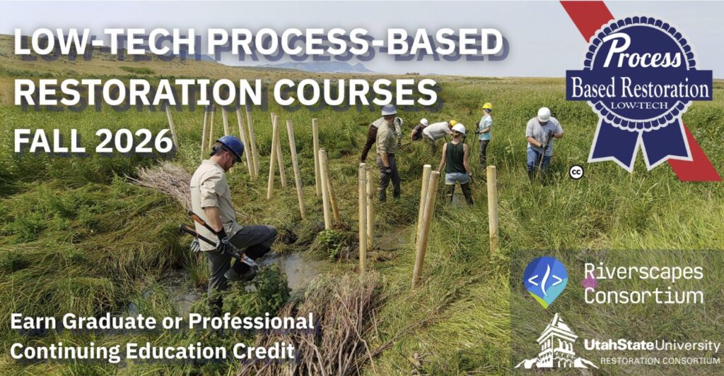
Once considered an unconventional approach, LTPBR is increasingly being taught and used by universities, federal and state agencies, tribes, conservation districts, watershed groups and restoration practitioners. Utah State University has become a leader in the field, incorporating LTPBR into university coursework and offering field-based training to students and working professionals. They offer an extensive no-cost online training course, plus paid options. The approach is also now incorporated into restoration programs and practices used by agencies including the Bureau of Land Management and USDA Natural Resources Conservation Service.
PBR, the Irony and the Arc
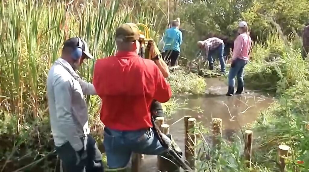
Tying it all together. PBR is an important part of the Arc, and thus it ties into the Irony and Arc discussed above. Here are two video that show this tie-in. The videos also capture the spirit of this “bicentennial” project, the history of the last 200 years, and what resourceful folks in central Oregon are doing now … and what you can do too.
Now, let’s extend this approach to a slightly more arid location – the Silvies River watershed in Grant and Harney counties:
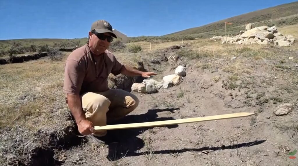
These videos show what central and eastern Oregonians are doing to re-assert control over water retention and improvement ecological function. They also show the fortitude and vision of individuals, family ranches, and small local groups that are step-by-step affecting beneficial change and undoing to some of the unfortunate acts of the past. Note that there are far more folks involved in these efforts than shown in the videos … and we, as a community, are grateful for the contributions of all.
Useful links
USDA – Incised Stream Restoration
Utah State – free online PBR course
Western Beaver Cooperative
Beaver Institute
Colorado Stream Handbook
Meaty PDFs
The Beaver Restoration Guidebook
LTPBR of Riverscapes Design Manual
Crooked River Watershed Assessment
Stream Restoration Resources in Central Oregon (Crook County, Grant County)
CREP – Conservation Reserve Enhancement Program. Payments to landowners to improve ecological function – including payments for PBR, vegetation enhancement, and other.
Contact: Bodie Brown, 541-447-8567, bodie@crwc.info
Beaver Works Oregon – Beaver and BDA related training, volunteer opportunities, and landowner support.
Western Beaver Cooperative – Landowner support related to beaver management and BDA installation.
Oregon Natural Desert Association – Landowner support, BDA training, and volunteer opportunities.
Crooked River Watershed Council – Landowner support, BDA training, and volunteer opportunities.
Crook County SWCD – Landowner support for restoration.
NRCS – Crook County – Landowner support for restoration, including payments to landowner.
Contact: Chris Mundy, 541-699-3177, chris.mundy@usda.gov
Deschutes Land Trust – lower Ochoco Creek restoration project.
Deschutes River Conservancy – water rights transactions and support.
Grant County SWCD – Great group that does a lot.
South Fork John Day Watershed Council – Landowner support, BDA training and volunteer opportunities.
Juniper
Western juniper is native to central Oregon, but historically it was much less widespread than it is today. Periodic fires confined juniper to rocky areas and other places where fire seldom reached. Beginning in the late nineteenth and early twentieth centuries, heavy grazing reduced the grasses that carried fire across the landscape, while organized fire suppression increasingly extinguished fires that did start. With fire largely removed, juniper expanded into former sagebrush and grasslands. That expansion accelerated as shown in the graph above and continues today.
This expansion matters because juniper use water—a lot of it. Their canopies intercept rain and snow, some of which evaporates before ever reaching the soil, while their extensive root systems draw soil moisture throughout the growing season. As juniper become denser, less water remains available for grasses, shrubs and other vegetation, and for groundwater recharge, springs and streamflow. Removing encroaching juniper therefore does more than restore sagebrush and grassland habitat; it also changes how water moves through and is retained within a watershed.
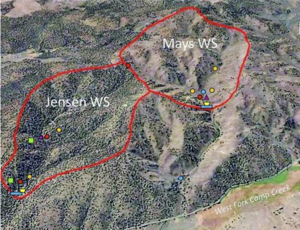
But how much difference can juniper removal actually make? Researchers at Oregon State University have been studying that question using two adjacent watershed along Camp Creek in central Oregon. Juniper was removed from one (Mays) while the other (Jensen) was left untreated, creating a long-running, side-by-side experiment. Below are photos from a May, 2025, OSU Extension workshop at the experiment site. The site is on “working land” and grazed seasonally.
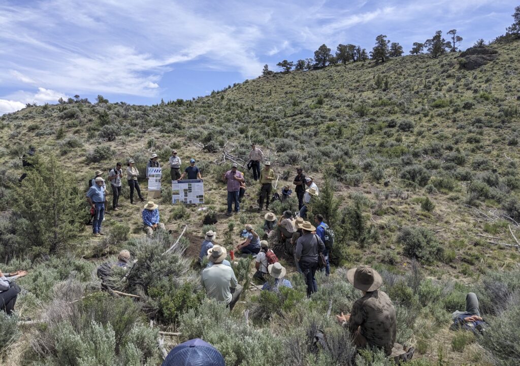
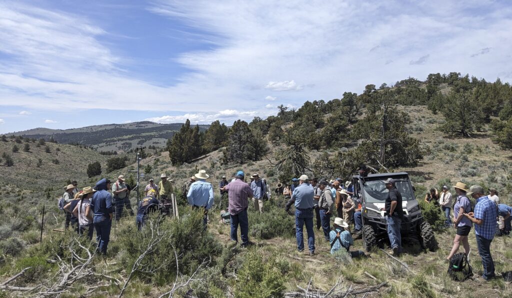
More than two decades later, the results are rather striking. The watershed where juniper were removed:
- produced greater spring and stream flow,
- held soil moisture and groundwater longer, and
- produced substantially greater and more diverse forage – forage production was nearly 3 times greater.
For more info on this paired study see:
https://ecohydrology.oregonstate.edu/project/juniper-hydrology-camp-creek-paired-watershed-study-ccpws-central-oregon
For Juniper Removal in central Oregon contact:
NRCS – Chris Mundy, 541-699-3177, chris.mundy@usda.gov
Crook County SWCD – Andy Gallagher, 541-447-3548, andy.gallagher@oregonstate.edu
Us
The Crook County Historical Society (CCHS) is a 501c3 nonprofit organization. The Bowman Museum is an entity of the city of Prineville. We operate collaboratively to provide historical and cultural programs for residents of Crook County, Oregon, and beyond.
Bowman Museum
246 N Main Street, Prineville, Oregon
541-447-3715
bowmanmuseum@gmail.com
Crooked River Bicentennial
a project of the CCHS
coordinator: Steve Sullivan
crooked1826@gmail.com
project | 200 years | river today | beaver | us